Groundwater modelling · Perth, Western Australia

Model the water
before you move
the earth.

GWC is a specialist groundwater modelling consultancy. We quantify how water moves through the subsurface — and how confident you can be in that answer — so mine planning, dewatering and licensing decisions rest on numbers, not assumptions.

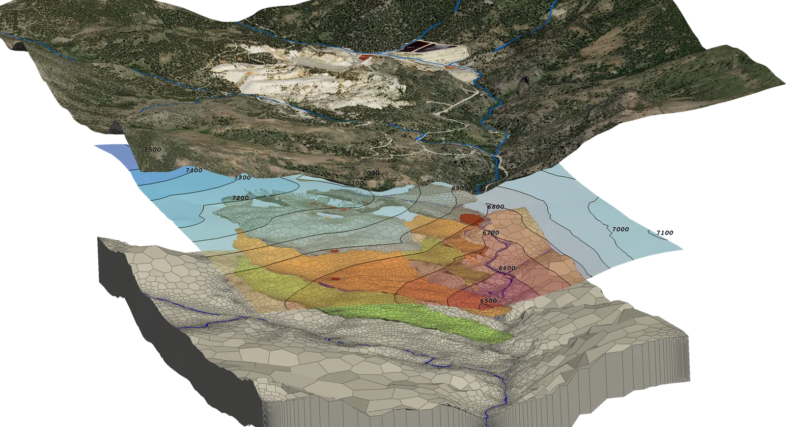
Exploded three-dimensional groundwater model: satellite terrain above a simulated potentiometric surface contoured from 6500 to 7500, over an unstructured Voronoi grid coloured by simulated head.

Projects delivered for

  • BHP
  • Rio Tinto
  • Fortescue
  • Mineral Resources
  • AngloGold Ashanti Australia
  • Barrick
  • Hancock Prospecting
  • Darkwater

01 — Capability

We investigate, assess and model every component of the water cycle.

A proven record delivering mine-water and infrastructure projects across Australia and internationally, with extensive expertise in remote and arid regions.

Service 01

Groundwater modelling

Numerical flow and transport modelling, saltwater-intrusion evaluation, mine dewatering and abstraction-impact assessment. Finite-difference modelling using the MODFLOW codes and finite-element modelling using FEFLOW, supported by analytical solutions for order-of-magnitude estimates.

Service 02

Water balance modelling

Whole-of-site water balances built in GoldSim — a probabilistic simulation platform suited to complex mine water systems. We simulate site water objectives and make long-term predictions on volumes and water quality under uncertainty.

Service 03

Data management & analytics

Collation and management of environmental datasets, with analytics, visualisation and automated reporting. Built around quality assurance, so the numbers reaching your regulator are the numbers your monitoring network actually recorded.

02 — Track record

Two decades of models that had to hold up.

Groundwater models get audited — by regulators, by lenders, by peer reviewers. Ours are built to survive that scrutiny.

Experience
20+

years in groundwater modelling

Dewatering designs
500+

construction dewatering schemes designed

Supervised
200+

dewatering projects overseen in construction

Reach
5

continents — Australia, Asia, Africa, Europe and North America

Selected projects

Iron ore — Pilbara

  • Mining Area C
  • Mt Whaleback
  • South Jimblebar
  • Wheelarra / Hashimoto
  • Orebody 18, 23/25, 29, 30, 31, 35
  • Eastern Syncline
  • Mt Helen orebodies
  • Marillana
  • Mesa J and Mesa H
  • Silvergrass
  • Bungaroo Valley
  • Brockman
  • Warranboo
  • Channar 64E5
  • Yandicoogina
  • Paraburdoo 4EE and 4W
  • Hope Downs 1 & 2, Baby Hope
  • Nammuldi
  • Marandoo
  • West Angelas
  • Tom Price — Section 6
  • Tom Price — Marra Mamba West
  • MacLeod North & South
  • Nyidinghu

Gold — palaeochannel investigations

  • Tropicana Gold Mine — AngloGold Ashanti Australia
  • Scotia Borefield — Bardoc Gold
  • West Musgrave — Oz Minerals
  • Carrapateena — Oz Minerals
  • Kundana, Pegasus orebody — Northern Star
  • Weednanna — Trafford Resources
  • Battler — Indus Mining

Potash & mineral sands

  • Lake Way — Salt Lake Potash
  • Lake Mackay — Agrimin
  • Lake Wells — Australian Potash
  • Yoganup — Iluka
  • Woonerup — Cristal Mining

Government & water utility

  • Kemerton Wastewater Treatment Plant, South West WA
  • Water Corporation WA — water panel member, 2020

International — construction dewatering & mining

Over 500 dewatering schemes designed and more than 200 supervised across the UAE, Bahrain, Qatar, Oman, Saudi Arabia, Libya and Lebanon — including the Nakheel Tall Tower and Palm Jumeirah Vehicular Tunnel in Dubai, Abu Dhabi Airport expansion, Sheikh Khalifa Stadium, Muscat International Airport, and King Abdulaziz International Airport in Jeddah. Further afield: Kolubara coal mine in Serbia, Oyu Tolgoi and Ukhaa Khudag in Mongolia, the Khanbogd Basin water supply study, and the Rössing uranium project in Namibia.

03 — Software & method

Industry-standard codes, used the way the guidelines intend.

We work with the latest USGS codes and follow GMDSI guidelines, with particular emphasis on stochastic modelling and explicit treatment of uncertainty. The deliverable is not a single prediction — it is a quantified range, and the risk that sits inside it.

  • MODFLOW

    USGS finite-difference flow modelling, structured and unstructured grids.

  • FEFLOW

    Finite-element flow and transport where geometry demands it.

  • MT3D

    Solute transport — contaminant migration and remediation design.

  • PEST / PEST++

    History matching, stochastic calibration and uncertainty quantification.

  • GoldSim

    Probabilistic site-wide water balance and long-range quality prediction.

  • AQTESOLV & AnAqSim

    Pumping-test interpretation and analytic element order-of-magnitude estimates.

What a quantified range looks like

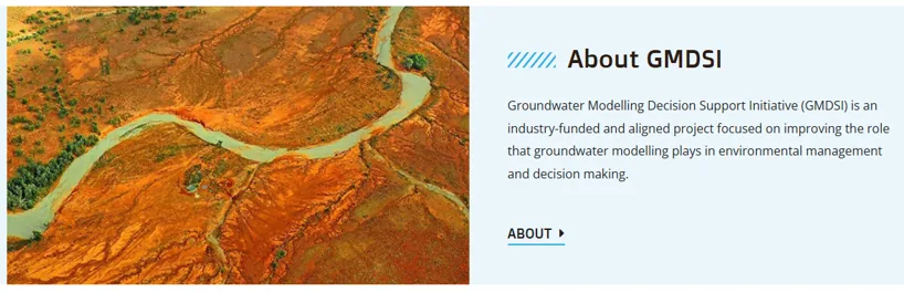
About GMDSI — the Groundwater Modelling Decision Support Initiative, an industry-funded and aligned project focused on improving the role that groundwater modelling plays in environmental management and decision making.
Our modelling follows the guidelines of the Groundwater Modelling Decision Support Initiative. Image and description courtesy of gmdsi.org.

04 — About

Small by design.

Groundwater Consulting Pty Ltd is an employee-owned company delivering integrated solutions across water, mining, environment and infrastructure for public and private clients throughout Australia.

Being small is the point. You deal directly with the modeller who builds your model — not an account manager. We are agile, flexible and responsive, and we have delivered successfully through a range of arrangements including semi- and full-time secondments into client offices. We work across the full mine life cycle, from feasibility through to closure, and draw on a global network of subject-matter experts where a project needs it.

“We turn your objectives into solutions.”
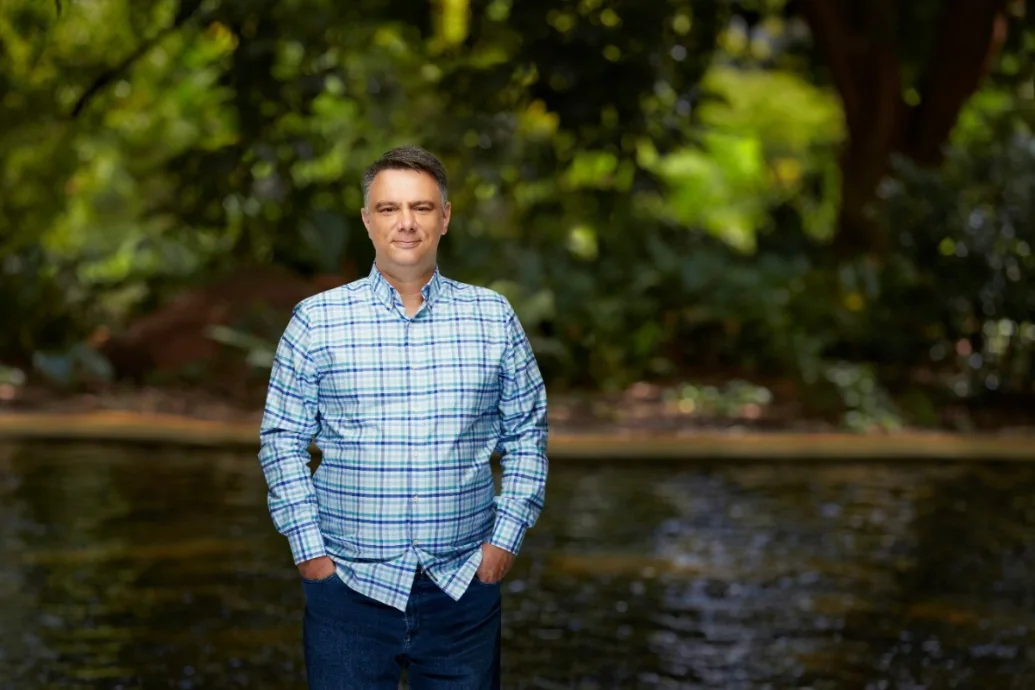
Milos Pavlovic standing beside a river, with dense green vegetation behind.

Founder

Milos Pavlovic

Founder & Principal Groundwater Modeller

Milos has more than 20 years of experience across a diverse range of groundwater modelling projects in Australia, Europe and the Middle East. He has led and contributed to modelling programmes for BHP, Rio Tinto Iron Ore, Fortescue, AngloGold Ashanti Australia, Iluka, Mineral Resources, Bardoc, Water Corporation WA, Iron Ore Holdings, Brockman Resources, Bannerman Resources and Ferraus.

His approach is deliberately pragmatic: the latest USGS codes, GMDSI guidelines, and a strong emphasis on stochastic modelling with PEST to address project uncertainty. The core of the work is quantifying risk — giving clients a defensible picture of what could happen, not just what is most likely to.

Internationally, Milos designed over 500 and oversaw more than 200 construction dewatering projects throughout the Middle East, and has contributed to coal, gold and uranium projects across Eastern Europe, Mongolia and Namibia.
  • MODFLOW
  • FEFLOW
  • PEST
  • GoldSim
  • GMDSI
  • Mine dewatering

05 — Contact

Got a project?

Tell us the problem and the deadline. If we are the right fit we will say so, and if we are not, we will point you to someone who is.

Phone
0426 956 693
Email
Milos@gwc.au
Located
Perth, Western Australia — working Australia-wide

Send an enquiry

We reply from Milos@gwc.au

Commodity, location, stage and what you need modelled.

Fields marked * are required.

06 — Groundwater tools

Drawdown calculator

Theis analytical solution with superposition across a well field, contoured over a basemap in your own projection. Free, no sign-up. It runs entirely in your browser — your well coordinates are never uploaded or stored anywhere.

Theis (1935) · superposition

Model setup

Well coordinates must be in this projection.

Wells

Paste straight from Excel — click a cell and press Ctrl+V. Columns: X, Y, rate (m³/day), start day.

Pumping wells: coordinates, abstraction rate and start day
# X Y Rate Start Remove

Drawdown at each well

Includes interference from all other wells.

Well Rate m³/d Drawdown m

Assumptions

  • Confined aquifer, infinite lateral extent, no boundaries.
  • Homogeneous, isotropic, uniform thickness.
  • Fully penetrating wells, negligible well storage.
  • Constant abstraction rate from each start day onward.
  • Water released instantaneously from storage.
  • No recharge, leakage, or unsaturated-zone response.

Real aquifers break these assumptions. Use this for order-of-magnitude screening — not for a licence application. Talk to us if you need more detailed analyses.